Capturing Change in the Flint Hills: Time-Lapse Photography Offers a New View of Prescribed Burning
By: Emerson Tarr
One photo can capture a moment of the Flint Hills landscape. Hundreds of photos taken from the same spot can show the changes that happen between those moments, giving people a chance to witness processes they may otherwise never see.
For Dr. Katie Starzec, an associate professor in agricultural and natural resources communications at Kansas State University, seeing those changes can create a sense of awe and curiosity, while also encouraging people to ask questions about what is happening on the land. 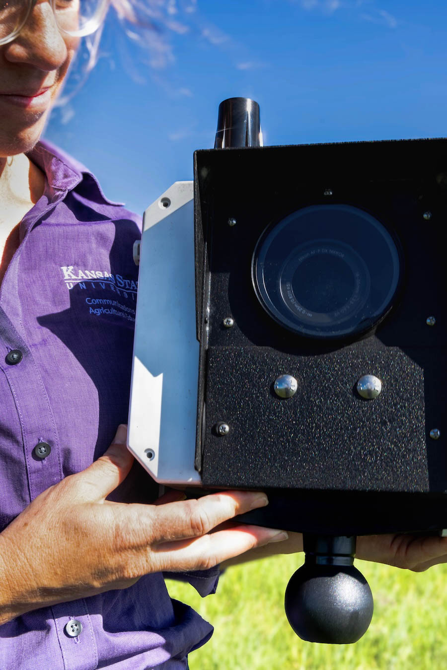
That idea is behind a time-lapse camera project led by Starzec. This spring, Starzec placed a camera at Rannells Ranch to document the landscape before, during, and after a prescribed burn. For Starzec, the project is about more than capturing fire. It is about making changes on the landscape visible and using those images to help people better understand the natural processes happening in the Flint Hills.
“Time-lapse photography to me is to illuminate processes that we don't necessarily see on a day-to-day basis,” Starzec said. “It's a way to help people ask questions about things that they don't witness in person.”
Starzec's interest in time-lapse photography started in graduate school, when her major professor made her take photos each time she visited a field site. Being able to compare what was happening both visually and numerically gave her a different way to understand what was happening at the field sites.
“There were some things we couldn't communicate with numbers,” Starzec said. “The differences and the changes through time in photography helped me learn and made me ask questions that I otherwise wouldn't have asked.”
The experience stuck with Starzec and became a passion she wanted to pursue in her professional career, which eventually led to her project at Rannells Ranch.
Starzec worked with Platte Basin Time Lapse, a project in partnership with the University of Nebraska–Lincoln, to determine what equipment was needed. The camera was mounted about eight feet above the ground and powered by a battery and solar panel. A cellular connection allowed photos to be uploaded to cloud storage and let Starzec remotely change how often the camera took pictures when needed.
When the burn arrived, the camera captured more than Starzec expected. The photos showed multiple fire lines moving across the pasture and eventually coming together within the camera’s view. As the camera continued documenting the landscape after the fire, it also captured rain events that occurred while the ground was still fresh from the burn.
For Starzec, those images show why continuous visual monitoring can be valuable. A visit to a pasture captures the conditions of one day, while the camera can show changes that happen between those visits.
“You get so much more visual data if you can see by the hour how things are changing throughout the day and how things are changing over weeks, months, at a time, sometimes years at a time,” Starzec said. This is the goal in the future; she hopes to build a “fleet of cameras” capable of collecting visual information from the same locations over a longer period of time.
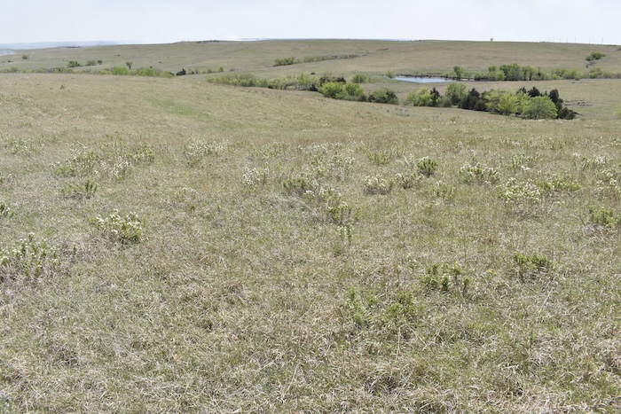
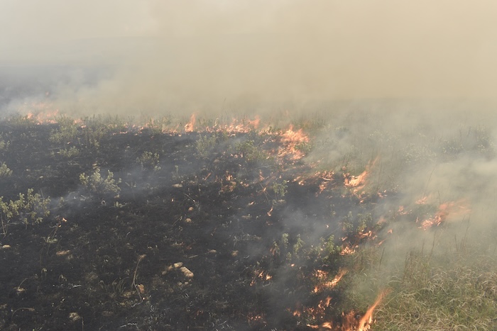
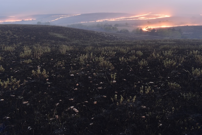
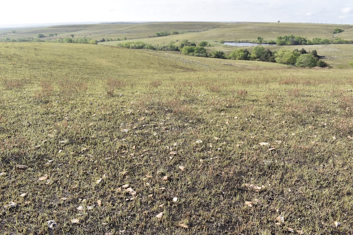
At Rannells Ranch, the project could become another way to share what is happening on the ranch and help others better understand processes like prescribed fire, grazing, and changes in the landscape. By making those processes visible, the images can give people a chance to see what they may otherwise miss and encourage them to look closer, ask questions, and become more curious about what is happening on the land.
“I'm really passionate about storytelling; about visual data and qualitative data and about generating awe and curiosity by showing people things that happen in nature," Starzec said.